I wish to wish all readers a Merry X'mas and Happy New Year. I will be travelling till late January 2009. During this period, I will not be able to psot new articles. However more interesting stories and photos will follow. Please check back regularly.
December 19, 2008
Merry X'mas and Happy 2009 New Year
December 12, 2008
The trees engulf the temple! Ta Prohm, Angkor Wat, Cambodia

Location: Ta Prohm Temple, Angkor Wat, Siem Reap, Cambodia (13° 26′ 6″ N, 103° 53′ 21″ E)
Date: 15 November 2002; 11.40am
Camera: Canon G1
One of the most atmospheric temples within the Angkor Wat complex is the Ta Prohm temple. The temple was totally swallowed by the jungle, literally, being covered by trees and their roots twinning all over the structures after centuries of abandonment and neglect. It more or less remains the same as the conservationists decided to leave the temple in the same state as it was found after it had been stabilised. Apart from the Buddha heads that adorned most of the temples of the Angkor, the winding roots of the trees around and engulfing the temple architecture is the next most recognisable icon of the Angkor Wat temple complex. Ta Prohm also gained fame as the location of the Tomb Raiders movie.
December 10, 2008
Sun set behind Singapore's skyline from Batam, Indonesia
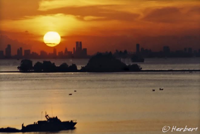
Location: Singapore skyline from Nongsa Marina, Batam, Indonesia(1°11'47.04"N 104° 5'52.71"E)
Date: 16 February 1996; 7.10pm
Camera: Minolta Compact
Batam is part of the Riau Island group of Eastern Sumatra. It has benefited tremendously from its proximity to Singapore with many companies based in Singapore setting up factories on the island. It also has many beautiful beaches, especially in the north of the island, rivaling some of the best of Asia. As such it is also a favourite weekend getaway for Singaporeans, who come to enjoy the beaches and the cheap and abundant seafood. It is so "Singapor-ise" that prices on the island are quoted in Singapore Dollars and are only marginally cheaper than in Singapore. The island is also well-known as a "mistress haven" where Singaporean men keeps Indonesian mistresses and only visits them during the weekend.
December 7, 2008
Panorama of St Peter's Square, Vatican, Italy

Location: St Peter's Square, Vatican, Italy (41° 54′ 8″ N, 12° 27′ 23″ E)
Date: 23 March 2006; 9.05pm
Camera: Canon IXUS iZoom
The Vatican is one of the most interesting places that I have visited while in Italy. It is so full of history and the arts in display there is just amazing. The architecture and stories behind the various structures are just as interesting. The place carries special significance if one is a Catholic. The Pope blesses the faithful gathered at St Peter's Square from the window of his studio at noon every Sunday. He also appears in person to attend the General Audience with the crowd every Wednesday. On most days the Square is full of both tourists and pilgrims.
December 4, 2008
Meru structure of Balinese temple, Besakih, Bali, Indoneisa
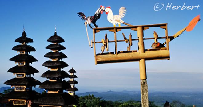
Location: Besakih Temple, Bali, Indonesia (8° 22' 0 S 115° 27' 0 E)
Date: 15 May 2001; 9.10am
Camera: Canon EOS 500N (analogue) on slides and scanned
Besakih is the holiest Hindu temple in Bali. It is situated at the foot of the holiest mountain in Bali, Gunung Agung. The temple was constructed in the 11th century in the unique Balinese temple architecture style with several multiple-levels pagoda-like structure known as Meru. To visit the temple, one needs to be dressed appropriately with sarong, sash and so on, as well as paying an entrance fee. However all these smack of squeezing money from tourists as it had been regularly reported that the entrance guard had demanded as much as US$30 entrance fee from each tourist. On top of that, guides are supposedly compulsory- and more money to be spent. That's why we did not bother to enter the temple grounds when we visited the place a few years back.
December 3, 2008
Red Karen Padung woman of Northern Thailand
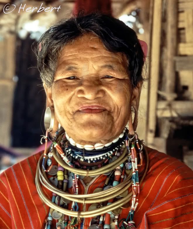
Location: Mae Hongson, Thailand (18° 45' 0 N 97° 55' 0 E)
Date: 5 November 1995; 1.45pm
Camera: (analogue) Minolta compact with negatives and scanned
There are many minority tribes in Northern Thailand and many of them are concentrated around Mae Hong Son district. Most of these tribes are indigenous to Thailand. However some of them also came to Thailand from neighbouring Myanmar to escape the war and persecution by the Myanmese military. Some of the members of such tribes had been in Thailand for over 20 years but are still on refugee status. The most famous of these are of course, the long-neck Padung Karen women who are been kept in zoo-like village to be visited by tourists at a fee. This photo is of another sub-group in the Karen Padung tribe- the Red Karen (Kayah) with long earlobe resulting from elephant tusks inserted in their pierced ear over the years.
December 1, 2008
Duck shepherd at Yongding, Fujian, China
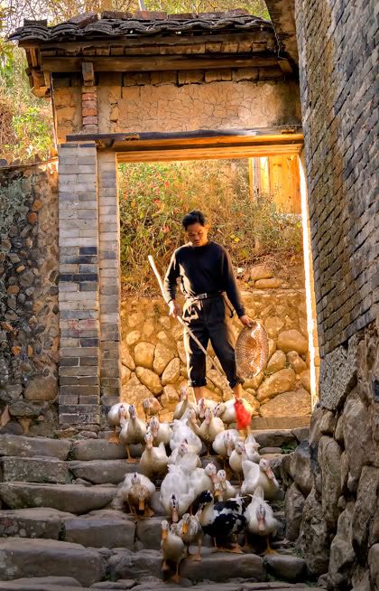 Location: Yongding, Fujian, China (24°38'14.18"N 116°54'27.63"E)
Date: 12 December 2007, 3.30pm
Camera: Canon 400D with Sigma 17-70/f2.8-4.5
In rural China, it is very common to see ducks being herded just like sheep by a duck shepherd. These ducks are left to roam around the farm or a specific area during the day. In the evening the owner or a member of the family will round the ducks up and lead them home. It is actually quick fun to watch these duck quack their way home.
November 29, 2008
Simple rural living at Vang Vieng, Laos
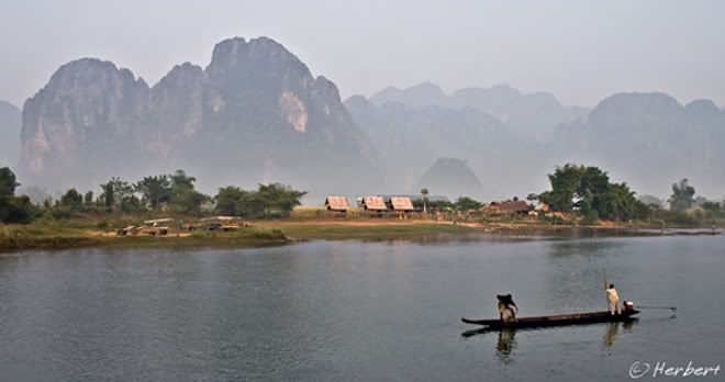
Location: Vang Vieng, Laos (18° 56′ 0″ N, 102° 27′ 0″ E)
Date: 4 November 2004; 7.20am
Camera: Canon EOS 300D with kit lens
Vang Vieng's landscape somewhat reminds me of the karsts region South China, the most well-known being those of Guilin and Yangshuo. Vang Vieng is also surrounded by limestone karsts and hills though they are not as tight and high as those of Yangshuo. Perhaps it is the Yangshuo before it was discovered by backpackers in the 1980's and the Disneyland-esque that it is now. At Vang Vieng today, one can still enjoy the simple, quaint and quiet rural setting that is common in most parts of Laos. However I wonder how long this will last as more commercial activities are springing up in the town.
November 27, 2008
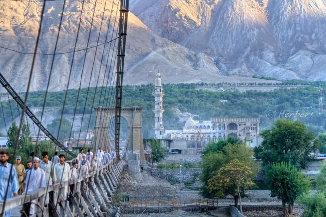
Sunset over the Gilgit Valley, Gilgit, Pakistan
Location: Jama Mosque, Gilgit, Pakistan (35° 55' 0 N 74° 17' 60 E)
Date: 19 July 2007; 6.05pm
Camera: Canon 400D with Sigma 17-70/f2.8-4.5
Gilgit is a major centre of transport and hub for anyone travelling in the Northern Region of Pakistan. It is the gateway to the various regions around here that are stubbed with marvelous and majestic mountains. It is also a town torn apart by religious strife, mainly between the Sunnis and Shiites. Sectarian violence between these two Muslim streams were so bad in 2005- where there were bomb blasts in the mosques and fights that left several dead- the two major mosques in the town had to be closed off to the public. Things sort of cooled down now but the tensions are still simmering below the surface; though none of these is obvious and should not deter anyone from going to this beautiful town and region.
Jama Mosque is one of the biggest mosques in Gilgit. It is visible from most parts of the town. It lies in front of the road junction leading to one of two bridges that span the Gilgit River, the Gilgit Pul. This is an old solid hanging bridge which can even handle cars.
November 24, 2008
Repairing roof- Jokhang Monastery, Lhasa, Tibet
Location: Jokhang Monastery,
Date: 17 April 2003; 3.30pm
Camera: Canon G1
Jokhang Monastery (大昭寺or Dàzhāosì) built in the 7th century is one of the most sacred monasteries in
Repairing and reinforcing the roof is still a community affair, undertaken by volunteers and pilgrims. This is often done in groups. The volunteers would stand in line with a leveler- a long holder with a flat concrete slab at the end- and pound the roof top in sync with songs, to level the roof. It is very fun to watch the process as is captured in this video clip in one of my visits
November 22, 2008
Carved columns of Hoysala Temple, Halibidu, India

Location: Halibidu, Karnataka, India (13° 10′ 12″ N, 75° 52′ 12″ E)
Date: 1 December 2005; 8.50am
Camera: Canon 300D with kit lens
Halibidu was the capital of the Hoysala Empire in the 12th century. It is home to a temple complex that includes the ornate Hindu temples, Hoysaleshawara and Kedareshwara. The temples are dedicated to Shiva and Vishnu. The sculptures in this temple are very intricate and diverse in nature, varying from the customary mythological figures narrating episodes from epics such as Ramayana to animals, birds and beautiful dancing figures (Shilabalikas). Everywhere- doors, columns, inner and outer walls are covered with exquisite quality sculptures- some of the best I have seen in India. Apparently no tow sculptures in the temple are the same.
November 21, 2008
November 20, 2008
Look at these strangers!! Lake Inle, Myanmar
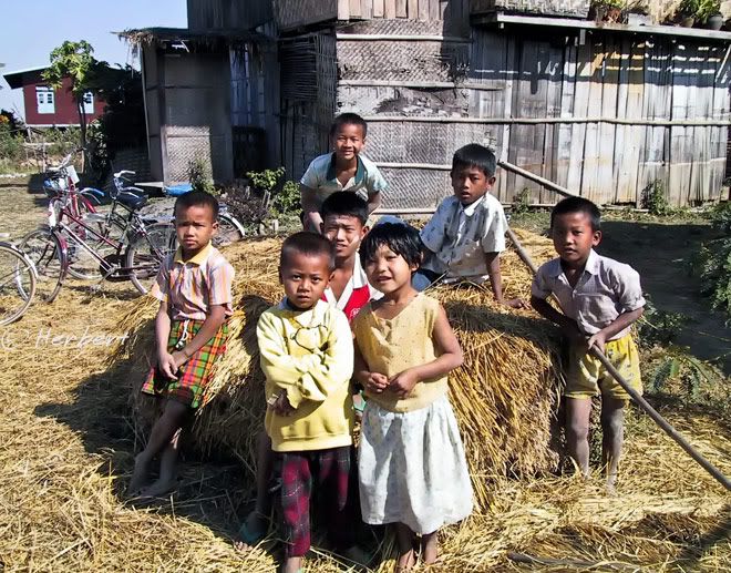
Location: Lake Inle at Nyaung Shwe, Myanmar (20°39′N 96°56′E)
Date: 17 December 2000; 10.15am
Canon EOS 500N (analogue) on slides and scanned
There are several villages around Lake Inle that are quite fun to visit. In 2000 most of these villages do not have many foreign visitors and the kids are really happy to see us. They are as curious about us as we are about them. However I am sure it is quite different now as Inle is one of the most popular and one of the few places open to foreigners in Myanmar. It is interesting that despite calls and appeals to foreign tourists to isolate and give Myanmar a miss, there are still hordes of tourists visiting the country. Personally I am not sure the boycott is the right way to go towards helping to push the country towards democracy or forcing the junta down. Tourists are not their mainstay of income but earnings (into the military's private pocket) from exports of resources such as timber, oil, gas and minerals. A better way is to encourage countries such as China, India and Singapore to stop allowing their shores to be used as well as dealing with the regime. On the other hand, contacts between tourists and locals, in my opinion, are beneficial as it is a means for foreigners to understand their plight close-up and an opportunity for the average citizens to be in touch with outsiders be convinced that they matters. Moreover tourist spending (at least the independent ones) in small ways directly help them economically.
November 17, 2008
Door of Tibetan Monastery, Gyantse, Tibet, China
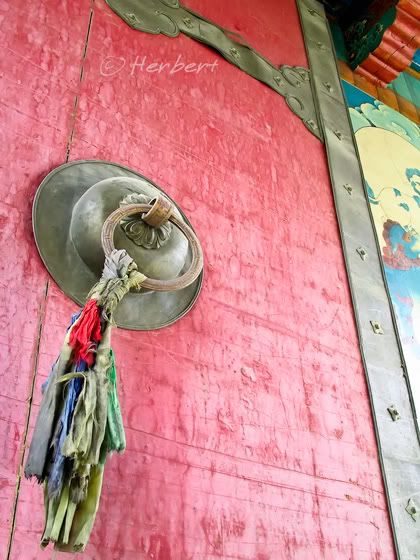
Location: Monastery in Gyantse, Tibet, China, (28° 57′ 0″ N, 89° 38′ 0″ E)
Date: 25 April 2003; 5.50pm
Camera: Canon G1
Tibetan monasteries especially the major ones normally have ornamentally decorated and brightly coloured doors. Most of these doors are made of heavy thick wood and stays strong for many years. These doors are commonly ringed by heavy-duty brass corners and knobs. The brass knobs also serve as "door bell" as visitors can knock the ring against the brass base to produce loud banging thuds.
November 15, 2008
Taking a break on becak, Yogyakarta, Indonesia
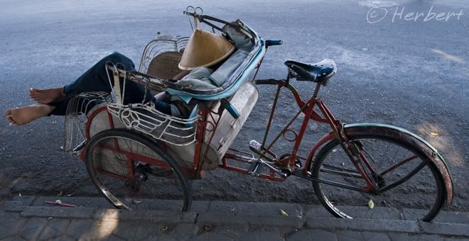
Location: Yogyakarta, Central Java, Indonesia (7° 47′ 0″ S, 110° 22′ 0″ E)
Date: 23 July 2008; 3.20pm
Camera: Canon 400D with Sigma 17-70/f2.8-4.5
Becak or rickshaw is a common sight in some parts of Indonesia. There are everywhere in cities such as Yogyakarta where it is a major means of public transport. Sometimes I wonder if the city can sustain so many becaks as there are virtually everywhere one turns. No wonder a lot of the becak drivers just idle on the roadside either chatting or like this one, using his becak as a bed.
November 13, 2008
A lone quiver tree or kokerboom, Namib Desert
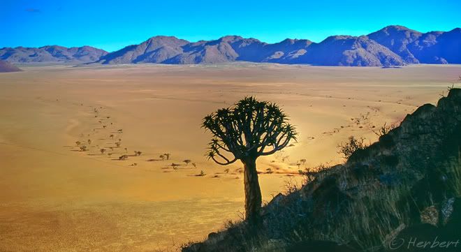
Location: Near NamibRand Nature Reserve, Namib Desert, Namibia (25° 2'8.68"S 16° 5'41.73"E)
Date: 14 April 2001; 4.25pm
Camera: (analogue) Canon 500N with slides and scanned
Quiver Trees are also known as kokerboom, and are a species of aloe indigenous to South Africa, specifically in the Northern Cape region, and Namibia. Its name was derived from the common practice of the Kalahari San Bushmen of hollowing out the tubular branches and bark to make quivers for their arrows. These trees are very rugged and are among the very few plants that survive in the dry, avid desert.
November 11, 2008
Bharirav, incarnation of Shiva, at Durbar Square, Kathmandu
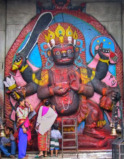
Location: Durbar Square, Kathmandu, Nepal (27° 43′ 0″ N, 85° 22′ 0″ E)
Date: 30 April 2003; 5.40pm
Camera: Canon PowerShot G1
Bharirav is tone of the fierce incarnations of Shiva associated with annihilation. He is one of the most important deities of Nepal, sacred to the Hindus and Buddhists. There is a Bhairirav statue in front of Durbar Square in Kathmandu. This sculpture is almost 12 feet, standing on the corpse of a devil which is the symbol of evil spirit signifying "good overcoming bad". The statue was brought here by King Pratap Malla in the mid 17 century from Raniban, a forest nearby Kathmandu.
It used to be free for anyone to roam around Durbar Square; however that has now changed. There is now an entrance fee of 500 Rs to enter the Square. This is supposed to be for the upkeep of the Square but honestly I could not see any differences or improvements betwwen my visits in 2000 and 2003.
November 9, 2008
Rice Terraces along the Ta Van River at Sapa, Vietnam
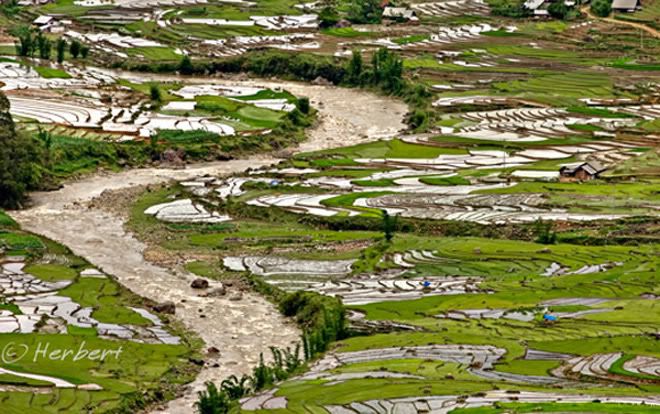
Location: Sapa, Vietnam (22° 21′ 0″ N, 103° 52′ 0″ E)
Date: 4 June 2005; 2.45 pm
Camera: Canon 300D with kit lens
Sapa is one of the most popular tourist destinations in Vietnam. It is well-known for its ethnic variety and attractive rice terraces. Though the rice terraces are nowhere near as breathtaking as those in certain parts of China (such as Yuanyang in Yunnan or Longsheng in Guangxi) or Banaue in the Philippines, there are still relatively amazing to those who have not been to these other places. There are many easy pleasant trails among the various villages around the rice terraces. Sapa today is actually a fairly touristy place with many eateries and souvenir shops catering to tourists but are exceptionally out-of-place in this ethnic-variety mountain town. Tourists who are keen to visit a destination with unique character and landscape but still want the familiarity of the food they enjoy, the shops selling stuff that they are used to in the cities will find Sapa very exciting. Purists who are interested in visiting a place for what it is will find this place over-developed and unauthentic. Sapa is close to the Vietnam-China border and so is easy to crossover from China. Border crossing is easy at Lao Chai.
November 7, 2008
Glittering Lights of Vegas
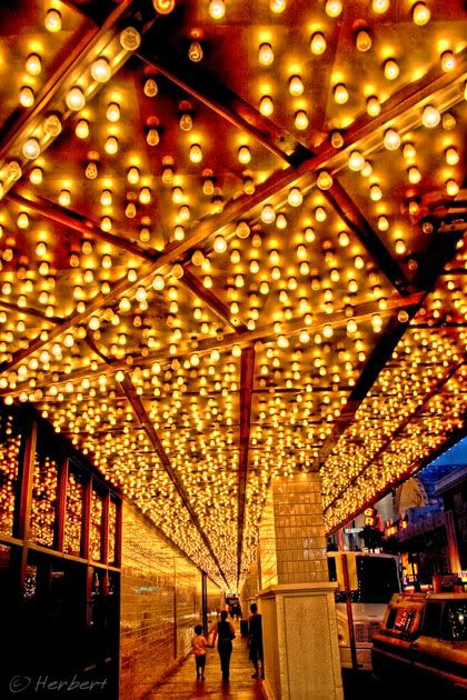
Location: Plaza Casino, Las Vegas, Nevada, USA (36°10'17"N 115°8'50"W)
Date: 10 September 2006; 6.15pm
Camera: Canon 300D with kit lens
Las Vegas is like a city of lights- neon's and all sorts of lights everywhere. This city must be consuming a tremendous amount of electricity, just for the lights outside all the casinos and resorts. Vegas is not as sleazy and crime-ridden as it used to be. Apparently it has transformed itself into a top family and convention destination. Apart from all the free shows and displays at the various casinos, what I like most is the casual dress code standard. One can go into any of the casinos wearing just a pair of shorts and singlet/tank top; unlike most of the casinos in Asia where a certain minimum standard of dress code- casual smart meaning longs with shoes etc- is required for entrance.
November 5, 2008
Night market at Devaraja, Mysore, India
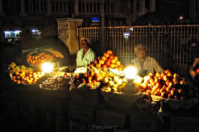
Location: Devaraja fruit and vege market, Mysore, Karnataka, India (12° 18′ 0″ N, 76° 39′ 0″ E)
Date: 2 December 2005 6.35pm
Camera: Canon Ixus IZoom
Mysore is a delightful city, though not as glamorous and developed as its neighbour, Bangalore. It still retains a lot of old charms such as the Devaraja Fruit and Vege Market. The market is a colourful and fun place to visit during the day and the activities extend into the night as well. These fruit sellers definitely do not differentiate between day and night.
November 2, 2008
Misty morning at Tsemi Pass to Mount Gonga, Sichuan
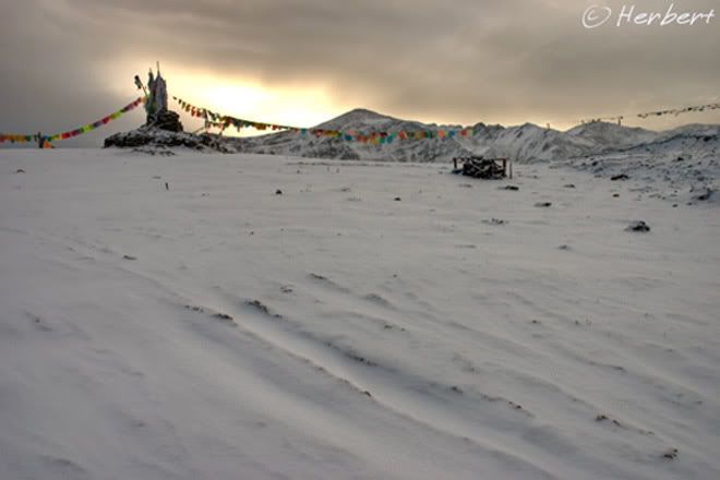
Location: At Tsemi Pass子梅山埡口 4440m, Sichuan China (29°31'3.49"N 101°43'13.67"E)
Date: 25 October 2006, 7.45am
Camera: Canon 400D with Sigma 17-70/f2.8-4.5
There are a several routes to the fabulously located Gongga Monastery (3,860m) at the foot of the Gongga Glacier below Mount Minya Gongga 贡嘎山, which is the highest mountain in Sichuan. At 7,556m the mountain is also the easternmost 7,000m peak in the world and the third highest peak outside of the Himalaya/Karakoram ranges. On the southwest approach, one has to cross the Tsemi Pass (4,440m) on the way to the monastery. The view of the triple peaks Minya Gongga is supposedly best viewed from this very windy pass. However the weather here is notoriously cloudy and foggy and one has to be rather lucky to have a panoramic view of the mountain from here. A typical morning view across the pass is like this photo- eerily quiet and cloudy. As this area is populated mainly by Tibetans, the pass is customarily decked with prayer flags as is the norm at most high vantage points and sacred locations.
October 31, 2008
October 28, 2008
Beautiful Classical Bali Temple
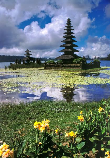
Location: Pura Ulun, Danu Bratan, Bali, Indonesia (8° 16' 60 S 115° 10' 0 E)
Date: 8 May 2001; 1.50pm
Camera: Canon EOS 500N (analogue) on slides and scanned
Ulun Danu Bratan is situated on the shores of the lake, Danu Bratan. The temple is supposedly half-Hindu and half-Buddhist dedicated to Dewi Danu, the Goddess of Lake. It is being looked upon as a source of irrigation for much of southern Bali and pilgrims from all over Bali pay homage to the temple to ensure continued and steady supply of water to the island.
The temple houses an intricately carved Buddhists stupa, an elegant 11-tiered meru (multi-roofed shrine) dedicated to Vishnu, a seven-tiered meru dedicated to Brahma and a three-tiered meru that houses a lingga to Shiva. There are also two small shrines inside the temple complex. It is one of the most picturesque temples in Bali, though not the holiest.
October 15, 2008
Fishing off the jetty at Pengerang, Johor, Malaysia

Location: Sungei Rengit, Johor, Malaysia (1° 21' 0 N, 104 ° 13' 0 E)
Date: 18 April 2008 6.40pm
Camera: Canon 400D with Sigma 17-70/f2.8-4.5
Sungei Rengit is a small fishing town in the Pengerang region in the south east corner of Johor state of Malaysia. It is a relax, quiet little town where fishing off the South China Sea is the main livelihood. Most fishermen go out to fish in the wee hours of the morning and return just after dawn. As a result seafood in and around the town is fresh, cheap and abundant. The people which is a mix of mainly Malays and Chinese are extremely friendly.
This part of Johor is like a playground for Singaporeans who go over, mainly in the weekends to cycle the quiet countryside as well as to enjoy the seafood and fresh fruits, which are much cheaper than what they would have to pay across the Straits. Visitors and cyclists with their bikes get across the border on what are known as bumboats; the ride takes about an hour. This part of Johor is also a golf haven for avid golfers as there are top quality two golf courses within the vicinity
October 13, 2008
Away traveling
Hi friends and visitors,
YOu may have noted that there are not many new articles lately nor are there any updates on materials such as slideshow and "photo of the month". The reason is that I am traveling for the last couple of weeks and will continue doing so for another two weeks. Updates and new photos/articles will be on the way once I return.
October 12, 2008
Baking Naan- Uigher staple food at Turpan, Xinjiang, Chinai
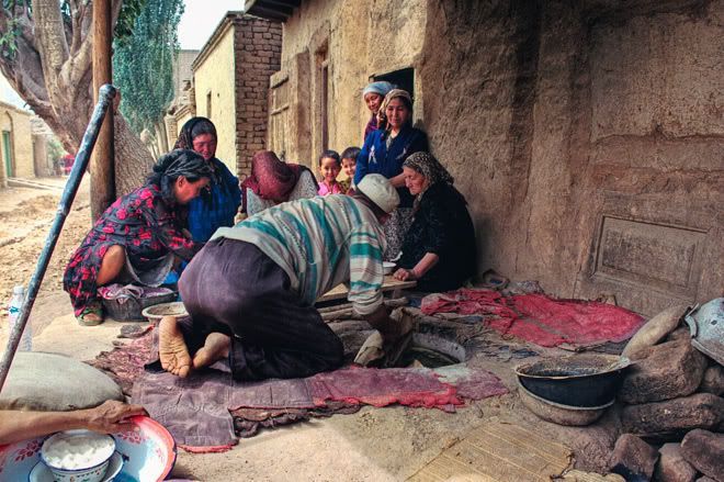
Location: Baking naan atTurpan, Xinjiang, China (42° 55' 60 N, 89° 10' 0 E)
Date: 20 May 1999; 1.10pm
Camera: (analogue) Canon 500N with negatives and scanned
One of the staple of the Uighur people of China is the naan bread. This is fairly similar to the South Asia continent naan except that it is round in shape and very thin. It is normally not flavoured with garlic etc as the South Asian version but just a sprinkling of cinnamon and light spices. They are baked the same way by placing the flour inside an earthen oven (in this case called a Tonur).
The naan is delicious when it is warm and freshly baked. Otherwise they are slightly hard but as they are thin, they are actually not that tough. Naans are kept at homes and eaten as and when wanted to, just like bread.
September 16, 2008
Jharkot village(3550m) squats under snow-capped mountains of Mustang on Annapurna Circuit, Nepal

Location: Jharkot (3550m) & the Mustang mountains from Muktinath on Annapurna Circuit, Nepal (28°49'5"N 83°50'56"E)
Date: 12 April 2000; 10.45am
Camera: Canon EOS 500N (analogue) on slides and scanned
This is the view that greets trekkers coming down the (somewhat dreaded) ThorungLa on the Annapurna Circuit after the beautiful Muktinath Valley. Jharkot is a small village dwarfed by the awesome snow-capped mountains of Daulagiri and the Tukuche peak. It is in the Mustang district which for a long time was closed to foreigners; as Mustang was a base of Tibetan fighters against the Chinese rule during the early days of the Chinese "liberation of Tibet". It is now possible to trek into Mustang with special permits arranged and guided by trekking agencies.
September 11, 2008
Atmospheric boulder ruins of Hampi, Karnataka

Location: Virupaksha Temple, Hampi, Karnataka, India (15° 20′ 9″ N, 76° 27′ 39″ E)
Date: 28 November 2005; 5.00pm
Camera: Canon Ixus iZoom
Hampi in Karnataka is located in the ancient city ruins of Vijayanagara, capital of the 12th century empire of the same name. It is an important religious centre over the ages with the Virupaksha Temple being considered the most sacred. It is fully intact among the surrounding ruins and are still used in worship. The temple is dedicated to Shiva, known here as Virupaksha.
The village and the surrounding ruins is in an atmospheric setting with huge boulders strewn all over the ruins, in any direction one look. Some of these boulders and rocks are quite beautiful, being eroded over the years by the elements. Amongst such rocks are various ruins including carvings on rocks.
September 8, 2008
Devatas on the walls of Angkor Wat, Cambodia
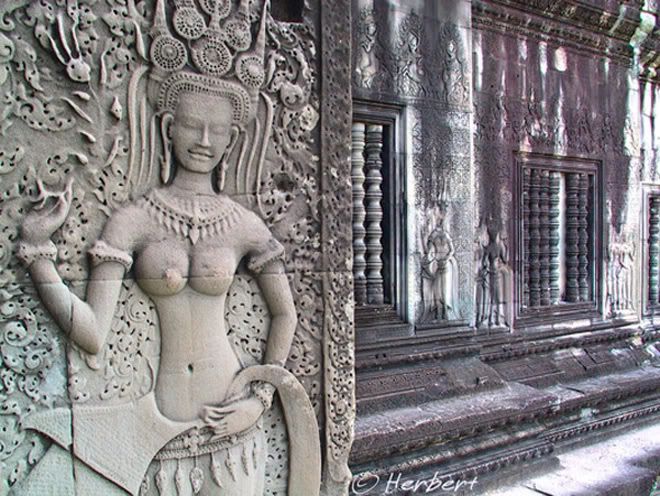
Location: Angkor Wat, Siem Reap, Cambodia (13° 24′ 45″ N, 103° 52′ 0″ E)
Date: 10 November 2002; 10.40am
Camera: Canon G1
The temples of the Angkor complex are replete with over a thousand images of apsaras and devatas. Both are supposedly minor female deities; whilst the apsaras are normally in dancing pose, the devatas are more demure and in welcoming pose. These carvings can be found all over the temple complex- on base reliefs, walls, pillars and doors. Devatas are supposedly guardian spirits, custodian of the religious shrines.
September 4, 2008
Mantras inscribed on mani stones and yak skulls, Tibet, China
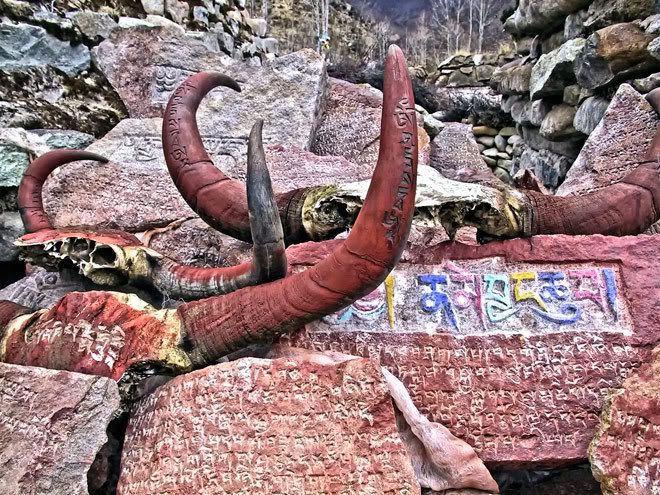
Location: Near Reting Monastery north of Lhasa, Tibet, China, (30° 6′ 23″ N, 91° 12′ 18″ E)
Date: 22 April 2003; 5.06pm
Camera: Canon G1
Tibetans inscribed Buddhist mantras such as 'Om Mani Padme Hum' and imagery on mani stones and deposit them in thousands of sites such as temples, road junctions, mountain passes, riversides, bridges and other sites that are imbued with spiritual essence. They are also symbols of worship and thanksgiving. Sometimes skulls of yaks are also inscribed with such mantras and added to a pile of mani stones to reinforce its power to protect people from natural disasters and evil forces. It is also very common for Tibetans who chance upon such religious piles to circumambulate them as a display of their religious piety and devotion. Such practices can be seen in many of the countries in the Himalayan region that practiced or had practiced Tibetan Buddhism such as Tibet proper, Nepal, the Ladakh and Sikkim regions of India and Bhutan.
September 3, 2008
September 1, 2008
Mist Transforms Cemoro Lawang Into A Dreamland, Bromo-Tengger-Semeru National Park, East Java
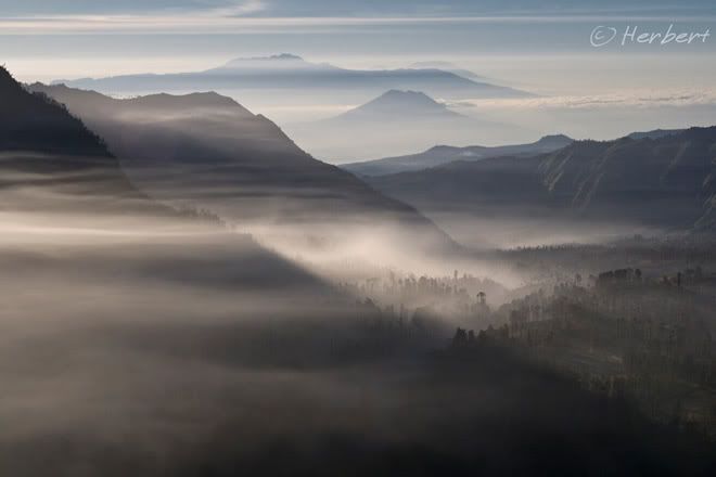
Location: Cemoro Lawang village, East Java, Indonesia (7°59'7.19"S 112°59'9.64"E)
Date: 16 July 2008; 7.30am
Camera: Canon 400D with Sigma 17-70/f2.8-4.5
The volcanoes of the Bromo-Tengger-Semeru National Park in Indonesia is really quite a surreal place. The landscape of the caldera and the views of the smoking volcanoes are like something from Mars (not that I have been there before). However equally impressive are the panoramic views across the other volcanoes and mountains to the north, away from the main Bromo-Tengger-Semeru group. Furthermore, like Indonesians in most parts of the country, the Tengger people of Cemoro Lawang (which sits on the rim of the Bromo caldera) and the surrounding villages are super-friendly. It is a delight to wander around the villages and soak in the rural serenity.
August 30, 2008
Happy Uigher kids at the Sunday Bazaar, Kashgar, Xinjiang
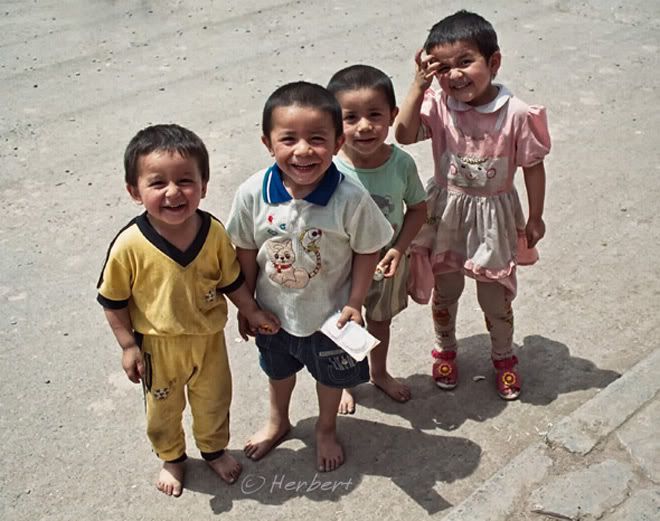
Location: Sunday Bazaar, Kashgar, Xinjiang, China (39° 45' 26 N 78° 24' 18 E)
Date: 5 June 1999; 10.10am
Camera: (analogue) Canon 500N with negatives and scanned
Kashgar, an oasis town on the western fringe of the Taklamakan Desert, Xinjiang, was an important stop of the ancient Northern Silk Route. In the last few years, it had developed into a busy tourist destination; a major hub to explore the rugged and stunning beauty of the surrounding desert as well as the snow-capped Pamir and TianShan ranges. As much as the stunning scenery, it is the incredible mix of people of the region which give colour to Kashgar.
One of its most well-known event and draw used to the Sunday Bazaar. The Bazaar had been a regular feature of the town for more than 2,000 years. During the Bazaar, the town's population would more than double when traders, herders, farmers and nomads from all over the nearby regions and far-flung countryside would come to town to trade. These would be people of different ethnic origin- Tajiks, Kyrgyz, Kazakhs, Uzbeks, Uighers, Mongols, Chinese- you name it. All sorts of things are traded here- from produce, every day needs to livestock such as sheep, cattle, horses and camels. In the old days there was only one lively, chaotic and magical Sunday Bazaar where everything including livestock are traded at the same location (different sector). This changed a few years ago when (supposedly) for hygiene reasons, the livestock trade was separated and located at a different location, just outside of town proper. To me, this has robed part of the magic and fun out of the Sunday Bazaar.
August 28, 2008
Apostles on Ocean? Port Campbell National Park, Australia

Location: 12 Apostles, Port Campbell National Park, Victoria, Australia (38° 39′ 57″ S, 143° 6′ 16″ E)
Date: 22 May 2008, 7.35am
Camera: Canon 400D with Sigma 17-70/f2.8-4.5
The 12 Apostles are a collection of limestone stacks off the shores along the Great Ocean Road in the Port Campbell National Park. There are actually only 8 of the Apostles left despite its name. This is perhaps the most well-known and visited destination in Victoria, probably also due to its proximity to Melbourne. The 12 Apostles can be quite spectacular especially when there are menacing skies from impending thunderstorms.
There is public transport to the 12 Apostles and there are heaps of one or two-day tours that run from Melbourne. There are also accommodation in the nearby towns such as Apollo Bay and Port Campbell as well as homestays at the farms. I stayed at the excellent 13th Apostles backpacker hostel at Princetown when I drove there recently.
August 26, 2008
The Seat of Power- Washington D.C., USA
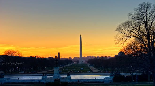
Location: Sunset behind Washington Memorial, Washington D.C., USA (38° 53′ 22″ N, 77° 2′ 7″ W)
Date: 7 March 2006; 5.30pm
Camera: Canon 300D with kit lens
One cannot escape the sense that Washington D.C. is a planned city with its neat broad avenues in tidy blocks, open spaces and landscaping. It is a city packed full of historical monuments, memorials and official buildings. Everywhere one turns, it oozes with the feel of officialdom and somewhat overwhelming security. However it is a pleasant place to spend a day or two visiting the well-known museums, institutions of arts and education.
August 25, 2008
August 24, 2008
Sculpture on A Historic Building In Florence, Italy
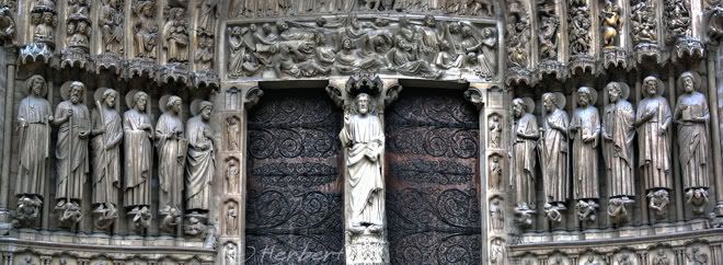
Location: Historic Centre of Florence, Italy (43° 46′ 13.08″ N, 11° 15′ 16.92″ E)
Date: 17 March 2005; 4.35pm
Camera: Canon IXUS iZoom
This is the entrance panel to one of the monuments at the Historic Centre of Florence. The problem is that there are so many such incredible marvelous sculptures and door panels around the Historic Centre (Duomo, Batistery etc) that I cannot recall which building does this belong to. I seem to remember that this is one of the sculptures above one of the door of the Baptistery; but I cannot be sure. Anyway Florence is an incredible place to spend a few days, to soak in the atmosphere, see the arts and monuments and relax in the centre of Renaissance. One doe not need to be a history or arts expert to enjoy Florence.
August 21, 2008
Suspension Bridge in Sagamartha National Park, Khumbu, Nepal
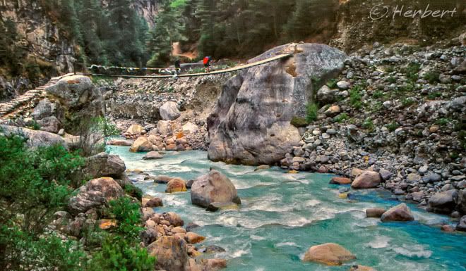
Location: Dudhkosi Bridge below Namche Bazar, Khumbu, Nepal (27°47'23.81"N 86°43'8.27"E)
Date: 29 April 2000; 9.25am
Camera: Canon EOS 500N(analogue) on slides and scanned
There are many deep gorges in the Khumbu region of Nepal, mainly before Namche Bazar on the way to Everest Base Camp. These gorges are formed by fast-rushing rivers. Suspension bridges are normally the only means across them. Some of the bridges are high above the river while others are just swung across boulders. Some of these crossings can be quite fun or nerve-wrecking, depends on your experience and state of mind. I definitely find them to be great fun.
August 19, 2008
Countryside at JiuLong, Sichuan, China
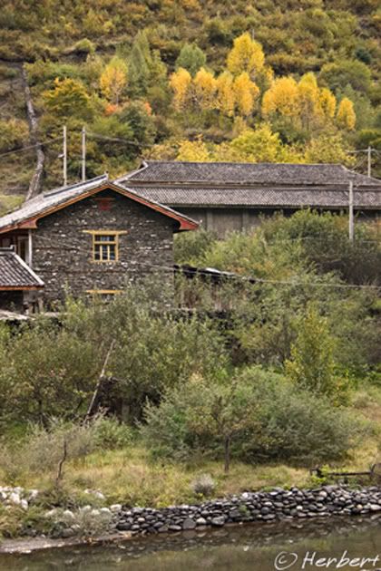
Location: JiuLong, Sichuan China (29° 1'2.40"N 101°29'30.15"E)
Date: 18 October 2006, 7.50am
Camera: Canon 400D with Sigma 17-70/f2.8-4.5
JiuLong 九龙 is a small one-street town in western Sichuan. It has a mix population of mainly Pomi Tibetans, Yi and Han Chinese, with the majority being Tibetans. However the local houses are predominantly of Chinese sloping tile roofs like this one, rather than the Tibetan-style flat roofs. The town is a main jumping off point to the stunning sceneries surrounding it. These includes a couple of beautiful alpine lakes such as WuXiHai and a deep gorge of the Yarlung Tsangpo Jiang (flows as Brahmaputra into the Indian Sub-Continent. It is in fact such simple rural sceneries with stunning landscapes within reach that keeps me going back to remote China.
August 17, 2008
A Springbok Among Devils' Thorn Flowers, Etosha, Namibia

Location: Etosha National Park, Namibia (18° 31′ 12″ S, 16° 16′ 30″ E)
Date: 19 April 2001; 4.25pm
Camera: (analogue) Canon 500N with slides and scanned
Etosha National Park was the largest game reserve in the world when it opened. However as a result of political changes, it is now only a quarter of its original size. Despite that, there is a bewildering range of animals which tend to concentrate around the waterholes within the park. The dry season is the best season to see these animals as they come to drink at the waterholes.
August 15, 2008
Golden Dome of Ananda Pahto, Bagan, Myanmar

Location: Ananda Pahto, Bagan, Myanmar (21° 10′ 0″ N, 94° 53′ 0″ E)
Date: 3 December 2000; 2.15pm:
Canon EOS 500N (analogue) on slides and scanned
Ananda Pahto is the first of the great temples in Bagan. It is one of the largest and by most acclaim, the most beautiful. According to the traditional story, it was built by a Myanmese King who was inspired by stories of their life in the legendary Nanadamula cave in the Himalayas, told by eight visiting Indian monks. The Ananda Pahto was built to recreate a vision of this cave. The temple then inspired the meritorious temple-building of later rulers.
Bagan should have been designated a UNESCO Heritage Site by virtue of its cultural, architectural and religious significance. However the military junta had restored the ancient temples and stupas in a haphazard manner, ignoring original architectural styles and using modern materials that bear no resemblance to the original designs. On top of that a paved highway, golf course and a tall watchtower was built nearby that guarantee its disqualification a UNESCO site.
August 13, 2008
The Romantic City of Light along the Banks of the Seine- Paris
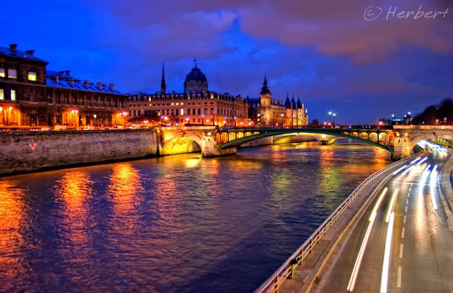
Location: Banks of the Seine, Paris, France, (48° 52′ 0″ N, 2° 19′ 59″ E)
Date: 27 February 2006; 7.05pm
Camera: Canon 300D with kit lens
Among the many nicknames of Paris (Romantic City etc), the most famous and the one I find most appropriate is the "City of Lights". It is known as such owing to its fame as a city of learning and ideas as well as its early adoption of street lighting. And the city is really all attractively lighted at night especially along the River Seine. I guess it is also this beautiful ambience along the river that earns it the romantic tag.
August 11, 2008
Sunset at Miri River, Sarawak, Malaysia
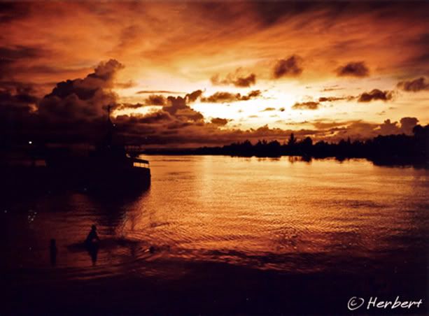
Location: Miri River, Sarawak, Malaysia (5° 17' 60 N 115° 10' 0 E)
Date: 11 November 1999; 7.15pm
Camera: (analogue) Canon 500N with slides and scanned
Miri is the gateway to Brunei’s capital Bandar Seri Begawan, which is about two hours drive away. Miri is often the stopover point for visitors travelling to the Gunung Mulu National Park. It also sits on the edge of huge tropical forest tracts of Sarawak and is a major port for the exportation of timber. Hence it is also known as the city of timber and oil.
It is the default entertainment centre for expatriates living and working in Brunei where alcohol is unavailable. Miri is the closest and easiest place for "thirsty" expatriates to get a beer or two.
August 9, 2008
Life Among the Limestone Islands of Halong Bay, Vietnam
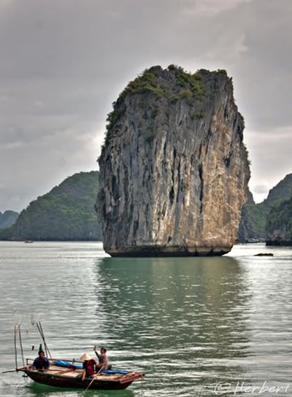
Location: Halong Bay, Vietnam (20° 54′ 0″ N, 107° 12′ 0″ E)
Date: 8 June 2005; 9.20 am
Camera: Canon 300D with kit lens
Halong Bay in north Vietnam consists of about 2,000 limestone monolithic islands, most of them topped with thick jungle vegetation. These islands rise quite spectacularly out of the ocean. Most of the islands are very small; two of them are big enough with permanent towns and settlements. There are also many clusters of boats connected with floating platforms that constitutes a somewhat permanent floating presence.
Halong Bay is one of the most popular tourist destinations in Vietnam. Many people just spend a day or two, taking a cruise around the islands or spend a night on a boat or on one of the two big islands. If you are planning to visit from Hanoi, it is cheaper and much easier to join one of the one or two-day packages offered at every corner of town.
Personally I felt that Phang Nga Bay in south Thailand on the shore of the Andaman Sea to be a much more spectacular experience. It is also less touristy and easier to visit independently.
August 7, 2008
Bronze Guardian Lion inside the Forbidden City, Beijing
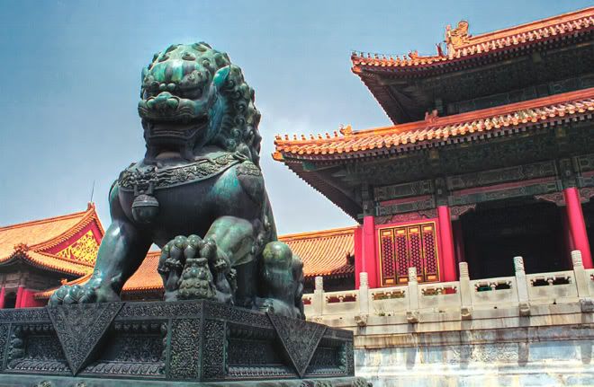
Location: Forbidden City, Beijing, China (39° 54′ 53″ N, 116° 23′ 26″ E)
Date: 7 May 1999; 11.50am
Camera: (analogue) Canon 500N with negatives and scanned
The Forbidden City was the Chinese imperial palace from the Ming to Qing dynasty, spanning a period of over 500 years. It served as the home of the Emperor and his household, as well as the ceremonial and political centre of Chinese government. After the Great Wall of China and Tiananmen Square, it is perhaps the most recognisable symbol and name of China's heritage.
It has now being renamed as the Palace Museum and underwent a massive renovation over the last few years. It was still awe-inspiring and majestic place to visit in 1999; I believed it remains just as magnificent today. I found that one of the best way to enjoy and understand the history and significance of the palace is to hire one of those audio guide device or better still (if you can afford it) get a guide to explain to you.
With the Olympics starting tomorrow, this place will no doubt be swamped by tourists, many visiting China for the first time.


